Engineered Precision Delivered
quick quiet efficient
sar/isr constellation
We align technical insight with disciplined execution to provide measurable gains across Design → Manufacturing → Integration → Testing → Launch → Operations.
australia “quill”
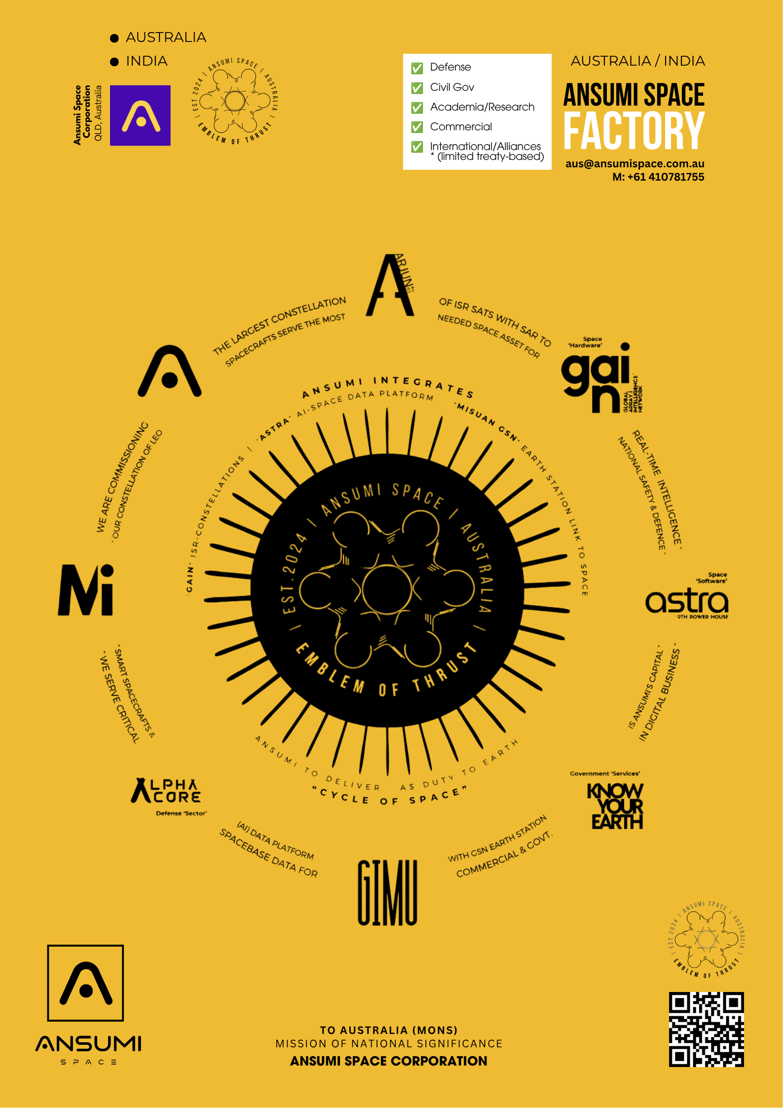
“Ansumi is building an integrated sovereign space ecosystem”
From human capability and spacecraft manufacturing, through launch and ground infrastructure, to space data, AI, intelligence and decision-making.


australia
-27°28'12" S
153°01'15" E
india
17°41'12.5" S
83°13'6.5" E
BUILT FOR INTELLIGENCE READY FOR ORBIT
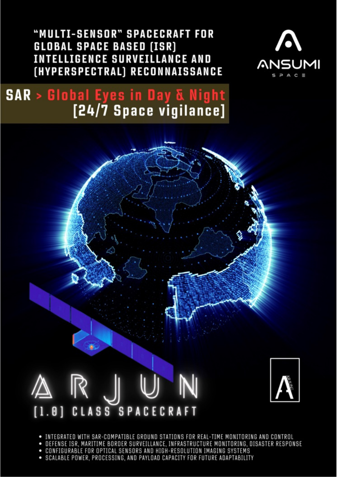
ARJUN is Ansumi’s modular Earth-observation and intelligence spacecraft platform, designed to integrate multiple advanced sensing payloads for persistent remote sensing, ISR, environmental monitoring and mission-specific data collection. Its configurable architecture enables ARJUN to be adapted to different missions, orbits and operational requirements while providing a common spacecraft platform for rapid deployment and scalable constellation operations.
ONE PLATFORM MULTIPLE missions
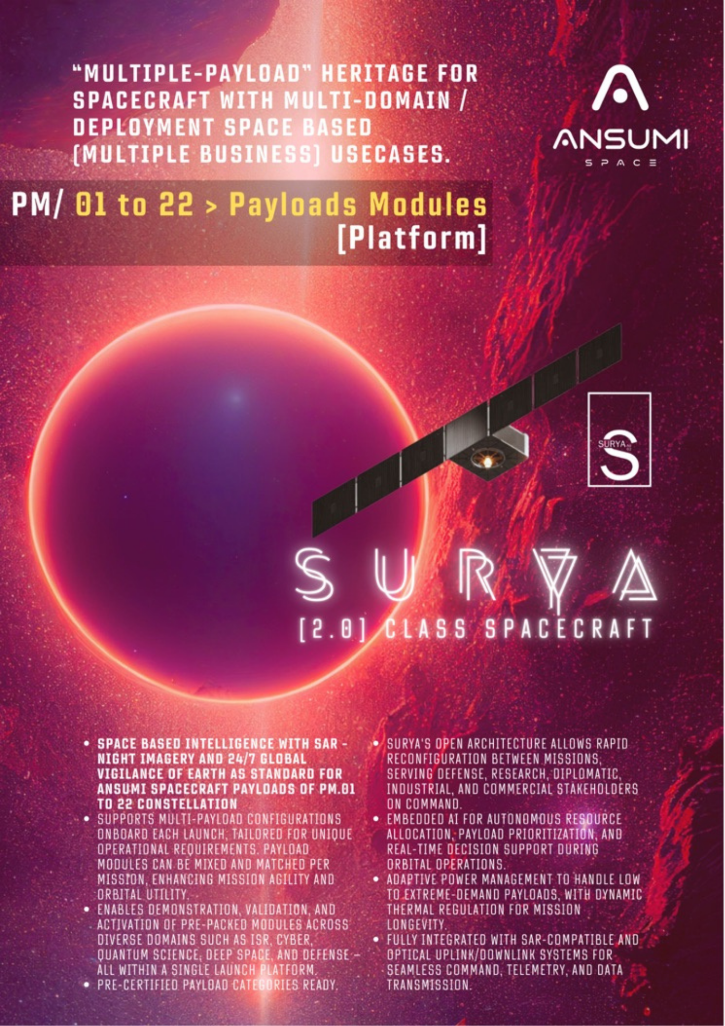
SURYA is Ansumi’s modular multi-payload spacecraft platform, designed to integrate diverse payloads for Earth observation, remote sensing, communications, scientific research and specialized space applications. Its configurable architecture enables SURYA to be adapted to different missions, orbits and operational requirements while providing a flexible spacecraft platform for rapid deployment and scalable constellation operations.
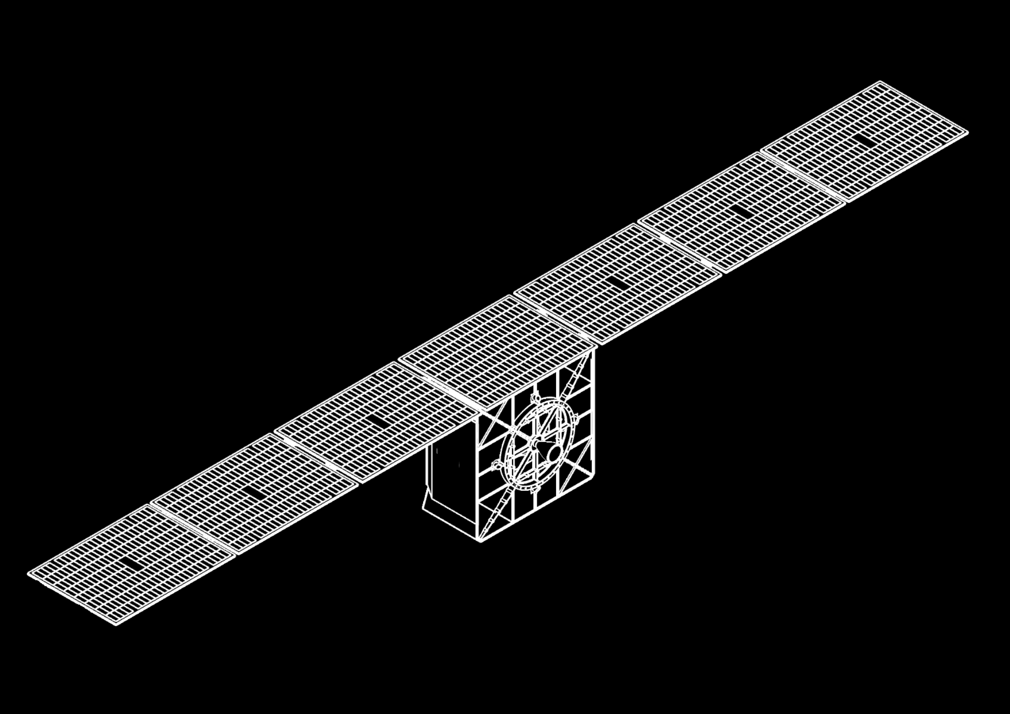
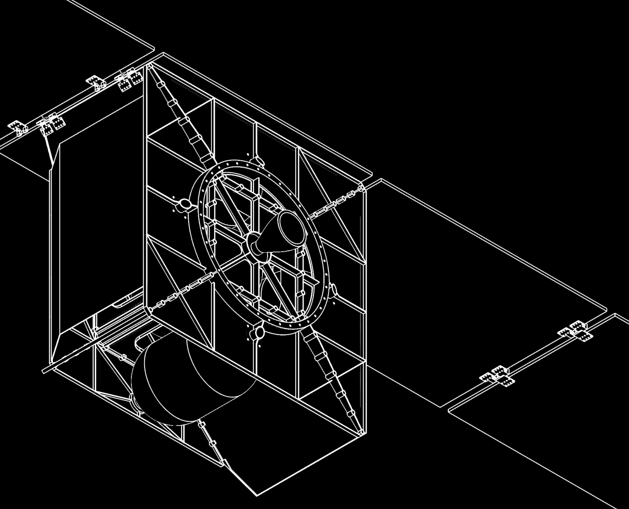
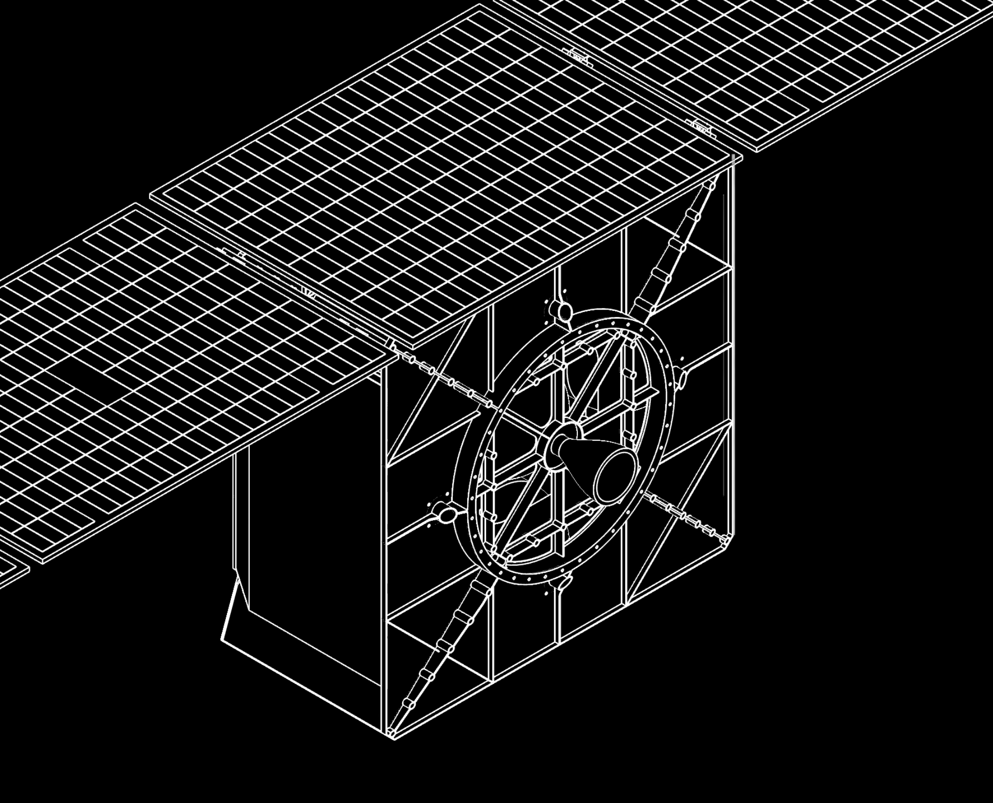
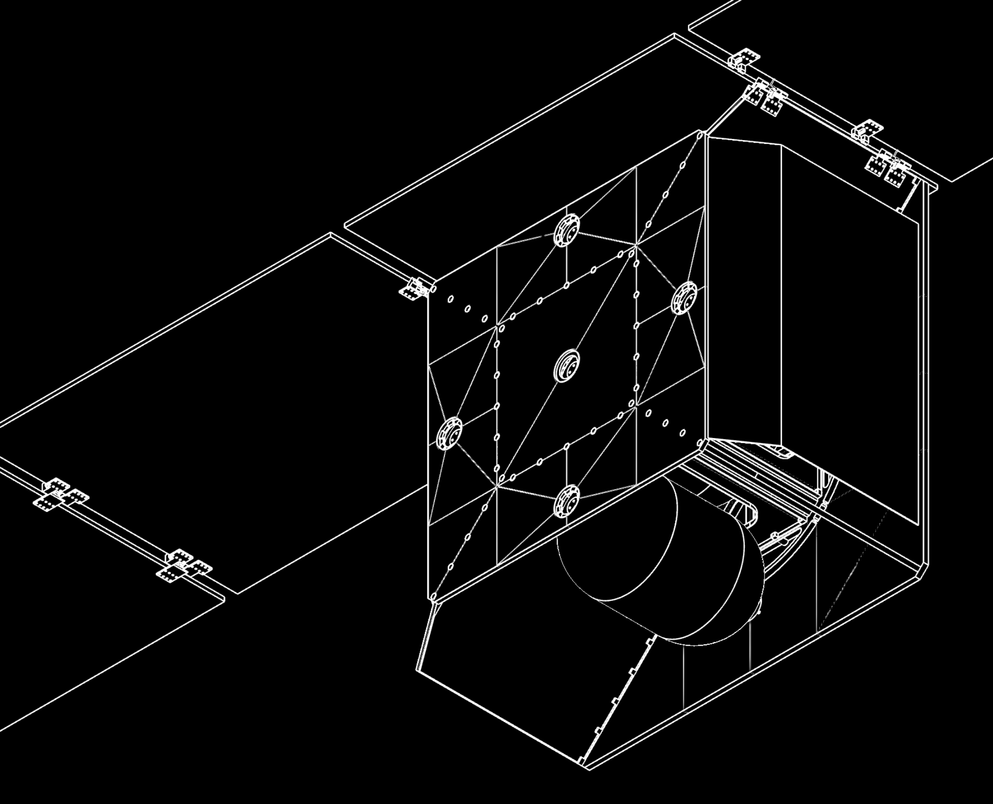
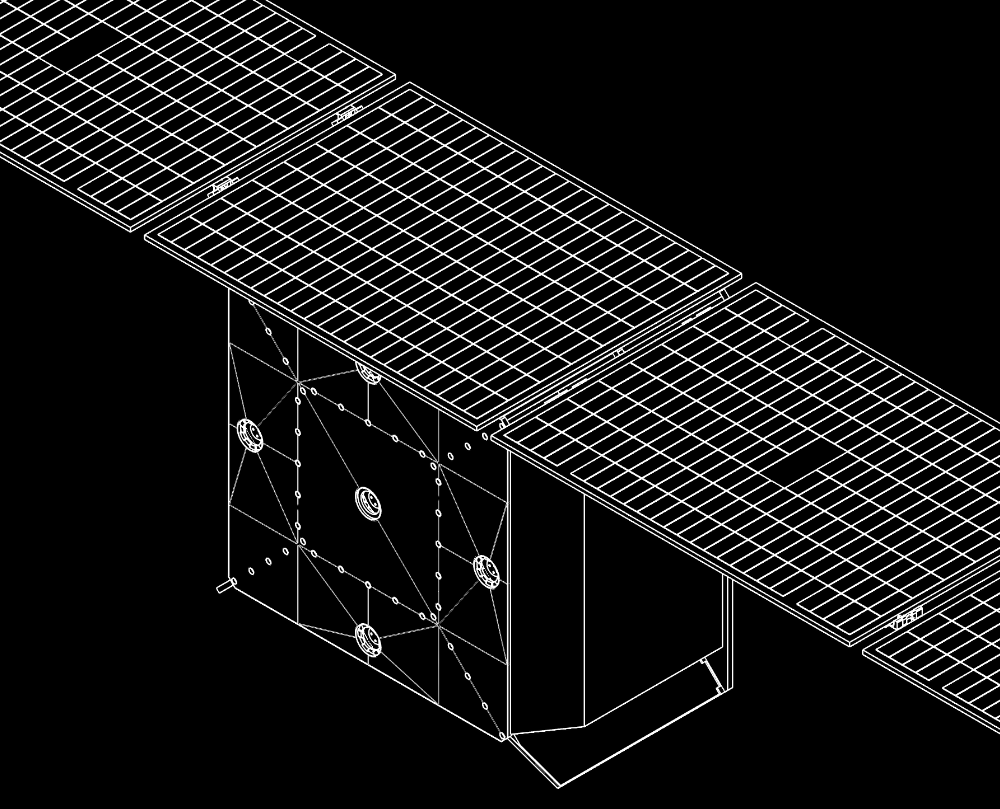
8.5 m - fully deployed > 8-11 years - life span > microwave thruster
ARJUN / SURYA : Day-and-Night Intelligence
The ARJUN–SURYA combination represents Ansumi’s approach to continuous Earth intelligence. Designed to operate as complementary spacecraft, ARJUN and SURYA extend observation capability across both daylight and night-time conditions, enabling a more persistent view of the Earth.
ARJUN is configured for daytime Earth observation and multi-payload remote sensing, while SURYA complements it with sensing capabilities suited to night and low-light operations. Together, they create a coordinated mission architecture in which the spacecraft can share the operational workload, complement observations and improve the continuity of information collected over an area of interest.
For Ansumi, this combination is a fundamental building block for scalable constellations. Rather than treating each spacecraft as an independent asset, Ansumi integrates complementary spacecraft into a mission system designed to deliver more persistent, responsive and actionable Earth intelligence across changing conditions.
ARJUN sees the day. SURYA extends the mission through the night. Together, they enable Ansumi to build a more continuous picture of Earth.
the roadmap of ansumi space
THAT BUILDS CAPABILITY
the CAPITAL


Ansumi converts capital into strategic capability rather than isolated expenditure. The initial portfolio of market rise for ₹1,045 Cr (100 mil USD) of revenue-ready capital across 8 strategic programmes, supporting to create a indicative ₹4,170 Cr (400 mil USD) ready-state portfolio. Capital is directed toward technology, design engineering, resources, manufacturing, infrastructure and mission execution, creating multiple pathways to future revenue.
THAT SERVES MULTIPLE MISSIONS
the TECHNOLOGY

Ansumi builds around reusable technology rather than one-product development. Our portfolio currently spans 8 strategic aerospace capability programmes covering propulsion, space systems, ISR / SAR autonomous systems, communications, optical networking, cyber-data and ground infrastructure. The objective is to make each major technology usable across multiple platforms, missions and markets, increasing utilisation.
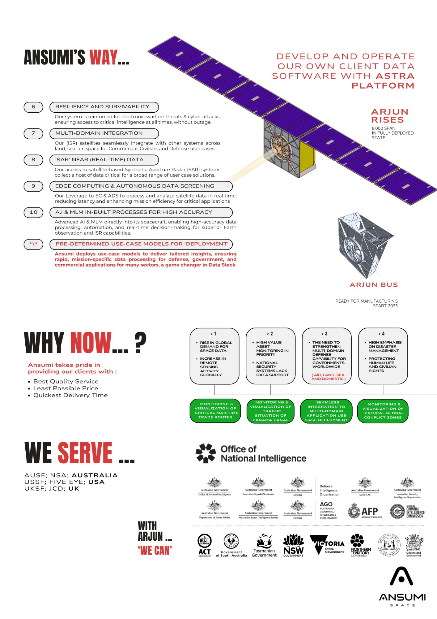
FROM CONCEPT TO MISSION
the ENGINEERING

Ansumi integrates engineering across the complete mission lifecycle: architecture, systems engineering, prototyping, modular link integration, qualification and deployment. Our 3–6 year development model progresses from longterm technology partnerships and engineering teams, through common components and mission systems, toward manufacturing, qualification and operational deployment. Objective: one platform for all missions.
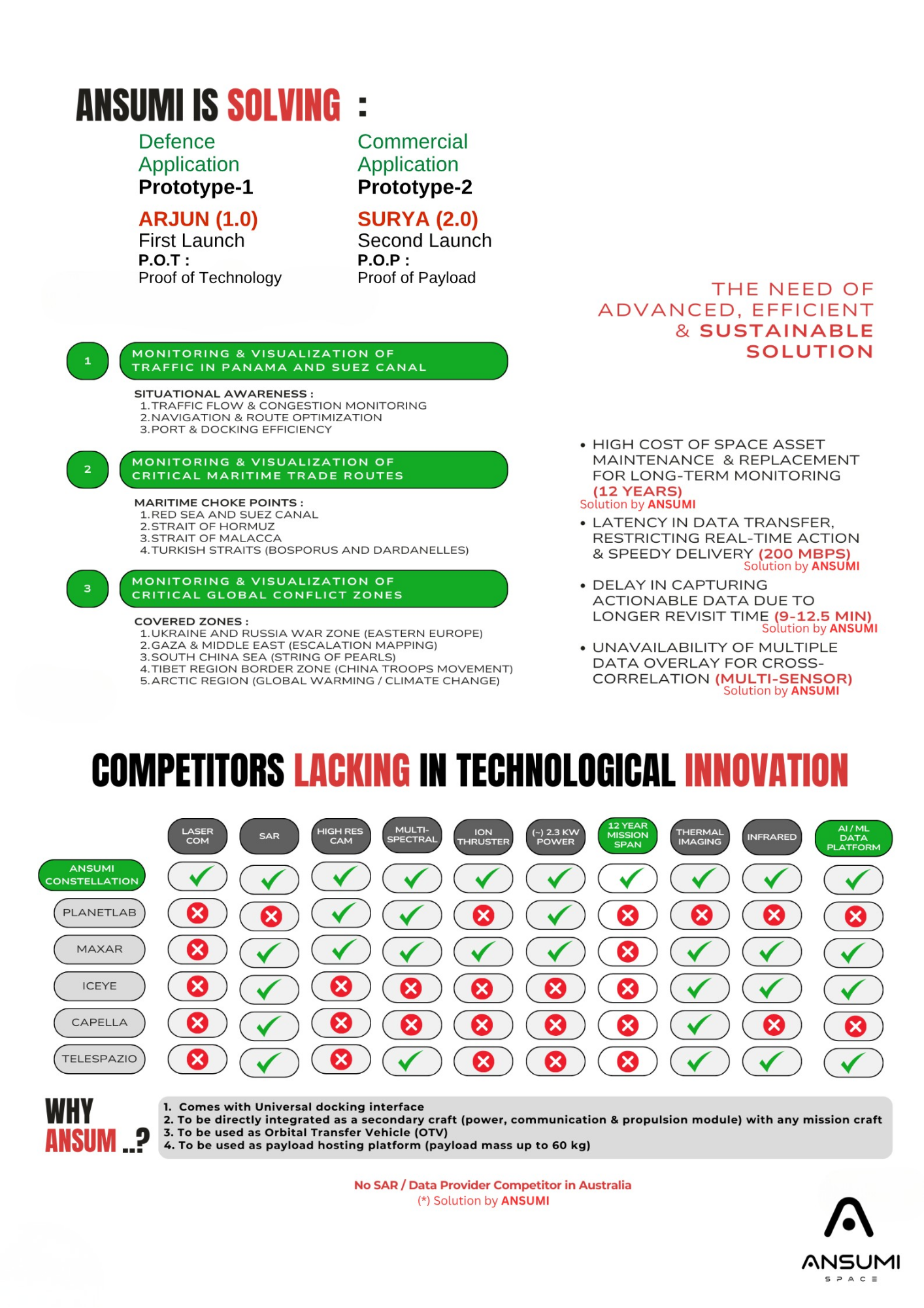
THAT SCALES MISSIONS
the MANUFACTURING

Manufacturing is the bridge between technology ownership and mission delivery. Ansumi's strategic portfolio identifies ready-state capability across creating opportunities for shared production, qualify, testing, integration and supply chains. Our objective is to progressively convert engineering capability into repeatable manufacturing, higher utilisation, lower unit costs and export-ready industrial capacity.
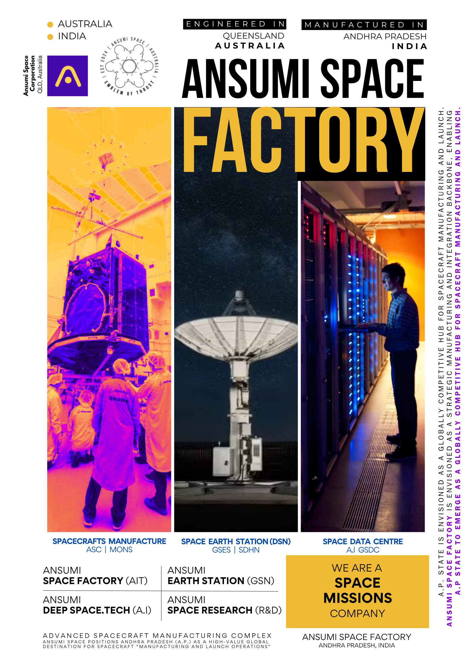
OWN MORE OF THE VALUE CHAIN
the BACKWARD INTEGRATION

Ansumi progressively moves upstream: HAVE, LOCALISE, STANDARDISE, BACKWARD INTEGRATE, INTERNAL SUPPLY CHAINS, EXTERNALISE. The objective is to reduce dependence on any of external suppliers while creating strategic upstream capability. Instead of purchasing every critical subsystem indefinitely, Ansumi seeks to develop common components, kits, electronics, software and manufacturing processes that can serve multiple programmes.
OUR COMPANIES CAN BUILD FOR EACH OTHER
the INTERNAL SUPPLY CHAIN

The Ansumi Alliance is designed as an interconnected industrial economy. One company can become another company's supplier, customer, technology provider or infrastructure user. To create multiple potential internal relationships across propulsion, communications, space data, autonomous systems, spacecraft, aerospace and ground infrastructure, creating a supply chain that is designed around capability reuse.
1 CAPABILITY, MULTIPLE REVENUE STREAMs
the CROSS-PORTFOLIO REVENUE

Ansumi's objective is to commercialise the same underlying capability through multiple programmes and markets. A single technology may support several products; one manufacturing asset may serve multiple customers; and one infrastructure investment may support multiple revenue streams. This transforms the model from 1 product, 1 market, 1 revenue stream toward multiple products, markets and revenue pathways.
BUILD ONCE. OPERATE. SERVE. REPEAT.
the RECURRING SERVICES

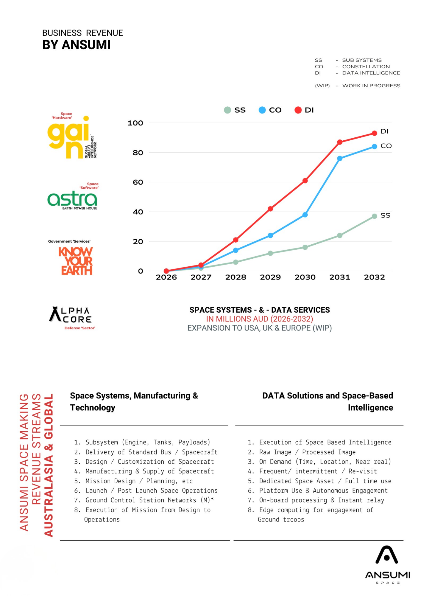
Ansumi's mission model extends beyond hardware delivery into recurring operations and services. The Year 4–6 strategy targets production scaling, recurring services, data services, communications, mission operations and maintenance, followed by technology licensing, joint ventures and exports. The objective is to transform mission infrastructure into continuing service revenue rather a one-time equipment sales.
FROM INTERNAL DEMAND TO GLOBAL MARKETS
the EXTERNAL CUSTOMERS

The Alliance can use internal programmes as an initial technology and capability market before commercialising the same capabilities externally. This creates a progression from internal capability, internal revenue, external revenue, export revenue. The strategy is designed to serve government, commercial and strategic customers of Ansumi while progressively expanding international markets and partnerships.
INDIAN CAPABILITY TO GLOBAL DELIVERY
the EXPORTS

Export is the final commercialisation layer of the industrial model. By Year-6, Ansumi's stated objective is to operate as an integrated industrial platform capable of hardware sales, systems integration, recurring services, data services, mission operations, technology licensing, joint ventures, grants, international partnerships and exports. Indian manufacturing, Indian technology exports, international services.
VALUE RETURNS TO THE MISSION
the REINVESTMENT

Ansumi's model does not end when a mission generates revenue. Revenue and enterprise value are intended to create capital for the next generation of capabilities. The strategic cycle is CAPITAL, TECHNOLOGY, ENGINEERING, MANUFACTURING, REVENUE, SERVICES, EXPORTS, REINVESTMENT, NEW CAPABILITY. This creates a planned mechanism for progressively expanding the industrial platform.
EVERY MISSION BUILDS THE NEXT ONE
the NEW CAPABILITIES

The ultimate objective is continuous capability creation. Over 3–6 years, Ansumi targets the formation and platformisation of its initial industrial capabilities; over the 10 years, the broader ASA–Aryabhata model targets 70,000+ cumulative qualified people, 15,000 to 18,000 direct jobs, 15,000 to 20,000 indirect/supply-chain jobs and potentially 200 to 500 aerospace, space and technology MSMEs.
CAPITAL BUILDS CAPABILITY. CAPABILITY BUILDS MISSIONS. MISSIONS BUILD REVENUE. REVENUE BUILDS THE NEXT CAPABILITY.
The core philosophy of the Ansumi Space Integrated Missions Group.
It fits the current global direction of the space economy. The market is increasingly moving toward integrated infrastructure, Earth observation, communications, data and recurring services rather than relying solely on one-off spacecraft sales. ESA's 2026 report, for example, values the 2025 upstream market at about €75B and downstream space-enabled markets at about €490B, while the World Economic Forum highlights recurring connectivity, intelligence and monitoring services as an important commercial trend.
ansumi “space our business”
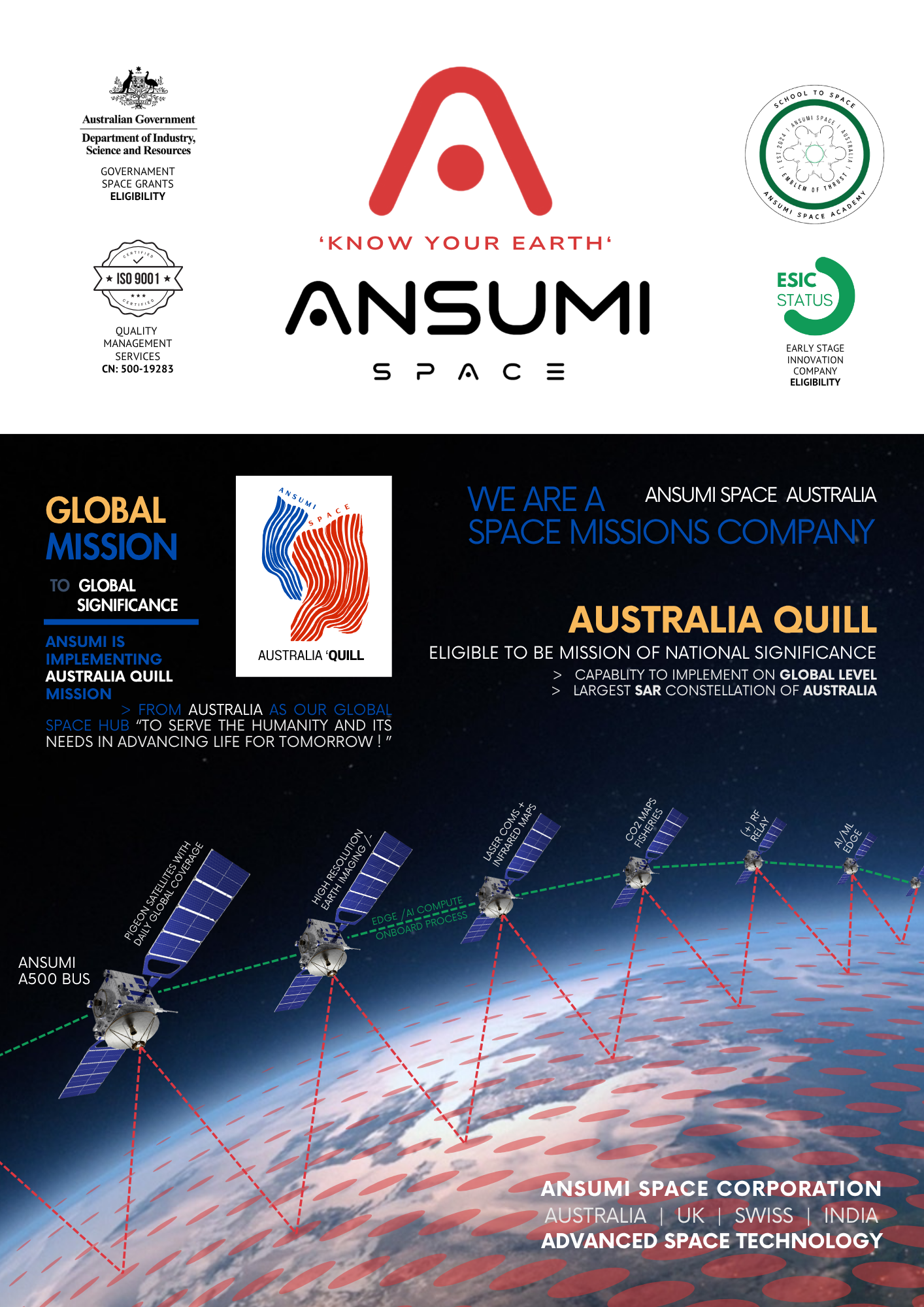
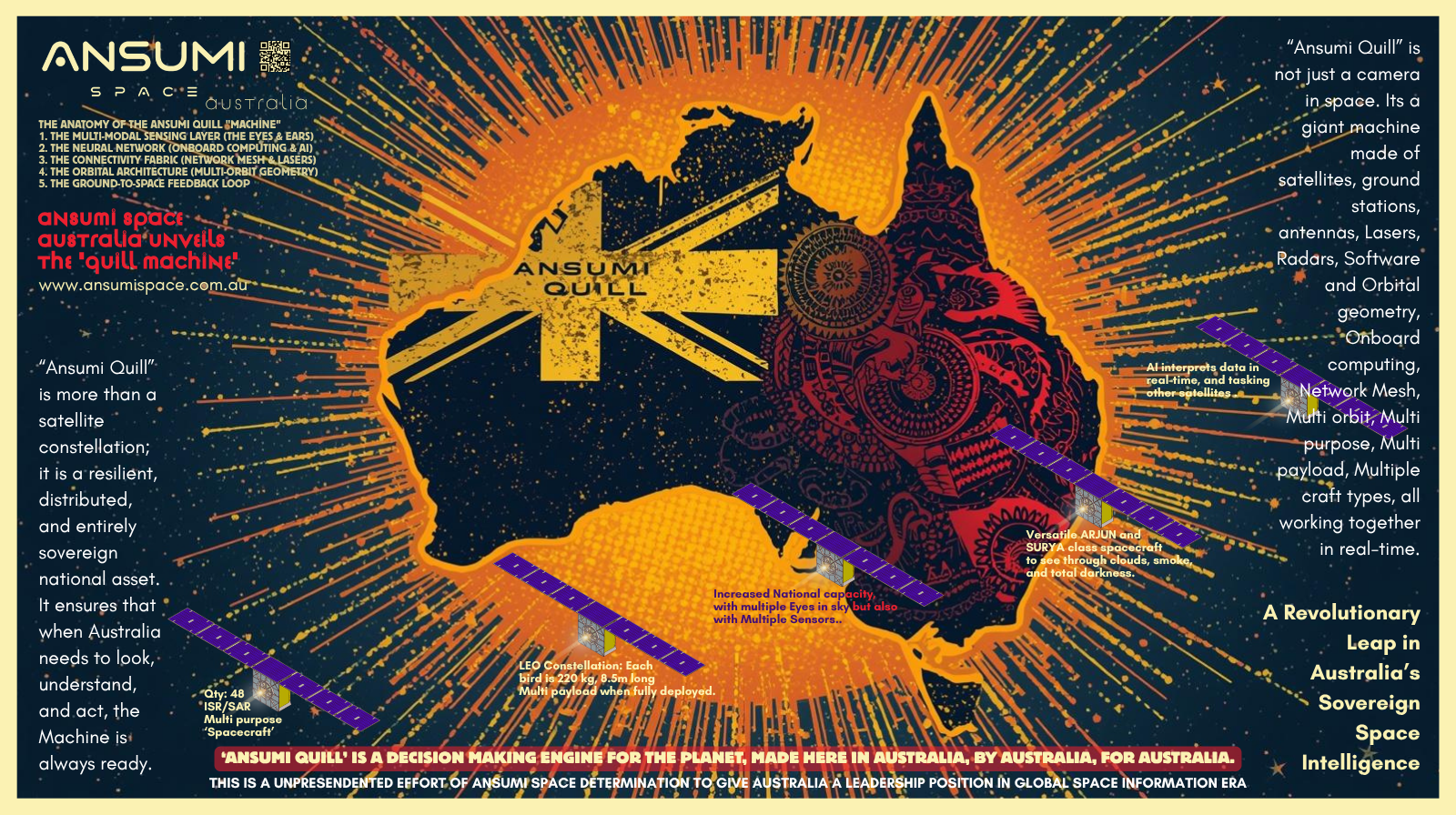
ANSUMI QUILL is a sovereign space decision making mission designed to transform space intelligence into strategic action.
QUILL integrates spacecraft, Earth observation, satellite intelligence, AI, communications, data infrastructure and advanced decision systems into a unified space-to-ground architecture. It enables nations and strategic industries to continuously sense, understand, predict and respond to activities and changes across Earth and space. QUILL moves beyond the traditional concept of space missions—from launching and operating spacecraft to creating actionable intelligence and measurable outcomes on Earth. It represents Ansumi’s vision of building an intelligent space infrastructure capable of strengthening national security, economic resilience, technological sovereignty and the next generation of the global space economy.
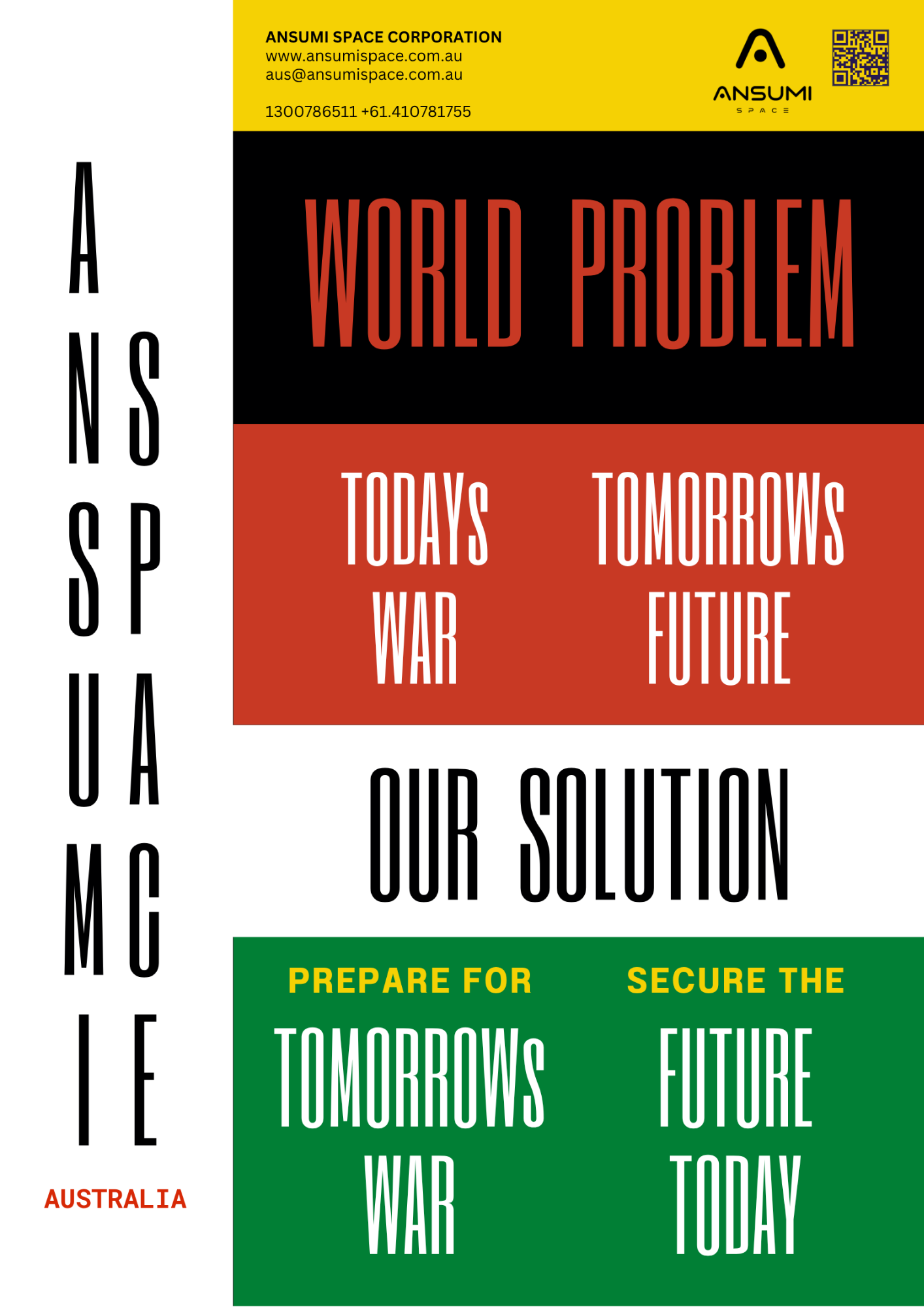
TODAY'S WAR. TOMORROW'S FUTURE.
The world is facing conflicts today that reveal the threats of tomorrow. Ansumi Space is building sovereign space capabilities to anticipate emerging challenges before they become crises. Through spacecraft, intelligence, AI, autonomous systems and advanced decision-making, we transform space into a strategic advantage—helping nations prepare for tomorrow's war, protect critical interests, strengthen resilience and secure a safer, more capable future today.
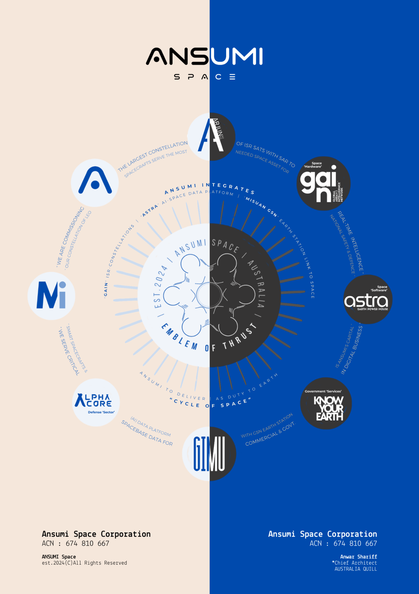
CYCLE OF SPACE
The Cycle of Space is Ansumi’s integrated space architecture connecting sensing, spacecraft, intelligence, communication, decision-making and action into a continuous operational cycle. From observing Earth to understanding threats, predicting change and enabling response, the Cycle of Space transforms space data into strategic capability—creating a persistent intelligence loop that protects nations, strengthens resilience and secures the future.
SENSE UNDERSTAND PREDICT DECIDE ACT REPEAT
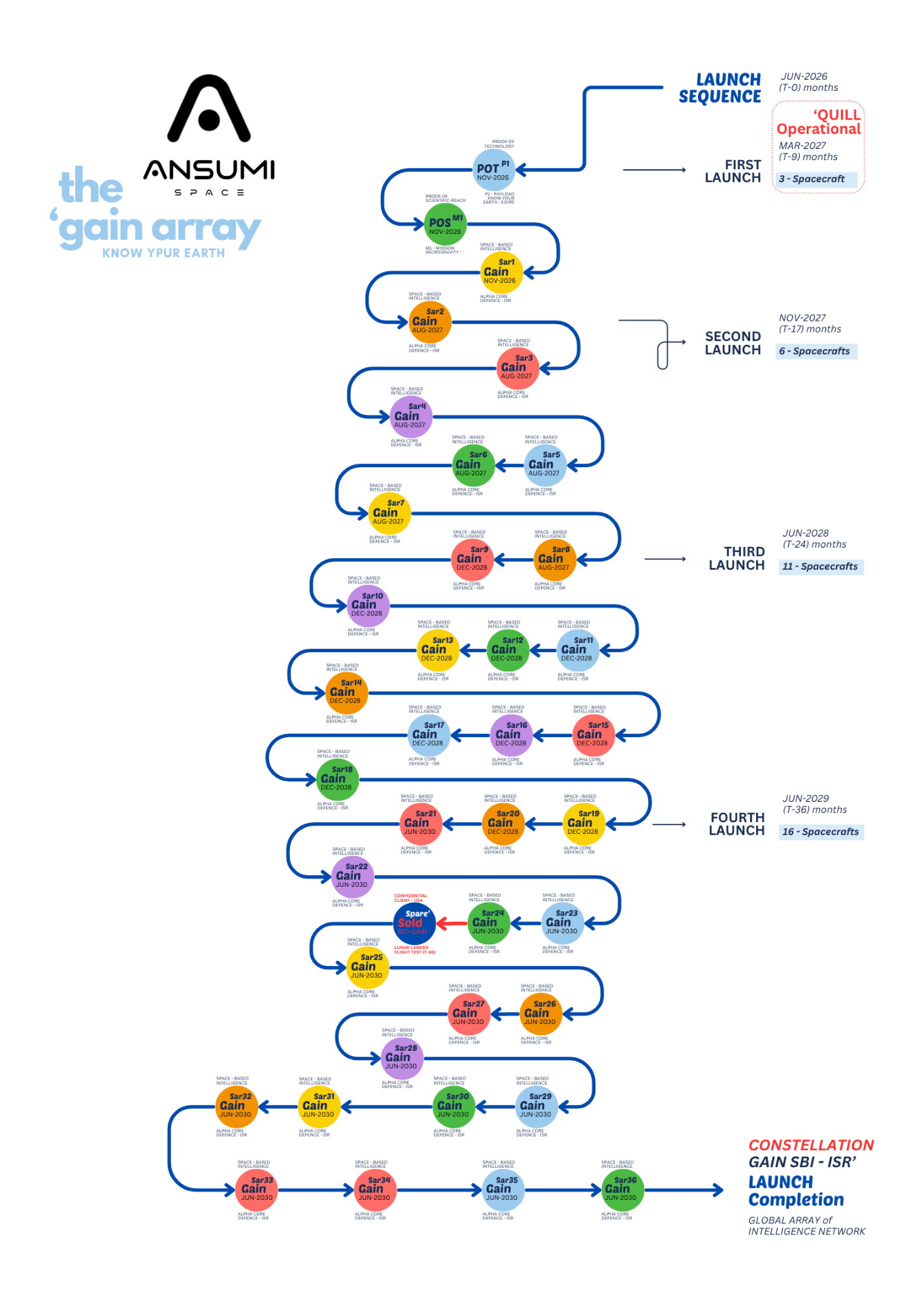
36 SPACECRAFT CONSTELLATION +(12) confidential
Ansumi Space is developing two Proof-of-Concept spacecraft to validate its next-generation ISR architecture and establish the foundation for a 36-spacecraft constellation.
The constellation is designed with Synthetic Aperture Radar (SAR) as a standard capability, enabling persistent intelligence, surveillance and reconnaissance across day, night and challenging weather conditions. By integrating SAR, optical sensing, AI and autonomous tasking, Ansumi is creating a continuously responsive space intelligence network—transforming observation into actionable intelligence and establishing a new standard for sovereign ISR capability.
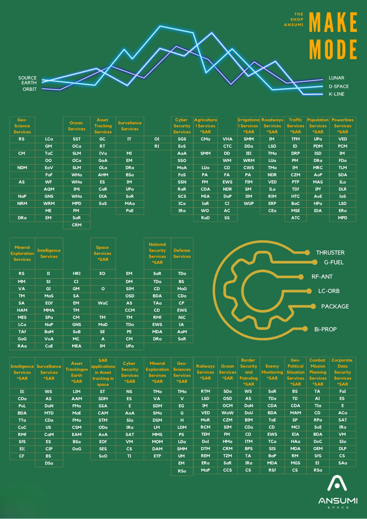
ansumi make MODEL SYSTEM
Ansumi has developed a Model System with dedicated system codes covering every spacecraft sub-task, process and manufacturing stage. From component development and assembly to integration, testing and qualification, each activity is systematically defined, coded and controlled. This creates a repeatable, traceable and scalable manufacturing architecture for producing spacecraft with consistency, speed and quality.
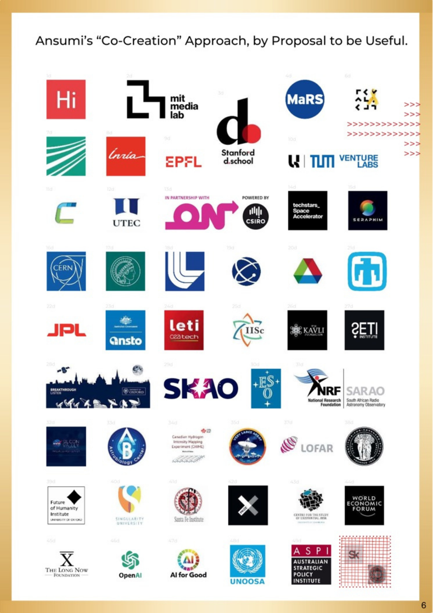
CO-CREATION IN ORBIT:
OPENING SPACE TO THE WORLD’S BEST RESEARCH
Ansumi Space is opening a pathway for leading research institutions and technology innovators to experiment, demonstrate and validate technologies in orbit. Through its Co-Creation Programme, selected partners can propose experimental payloads of up to 8–12 kg at no payload cost, subject to mission and technical requirements, aboard Ansumi’s Arjun and Surya 250 kg spacecraft platforms.
The programme spans emerging fields including AI, robotics, sensing, communications, materials, quantum technologies, biotechnology and autonomous systems. Ansumi’s vision is to reduce the barriers to orbital experimentation and help transform promising laboratory technologies into flight-proven capabilities for next generation of space missions.
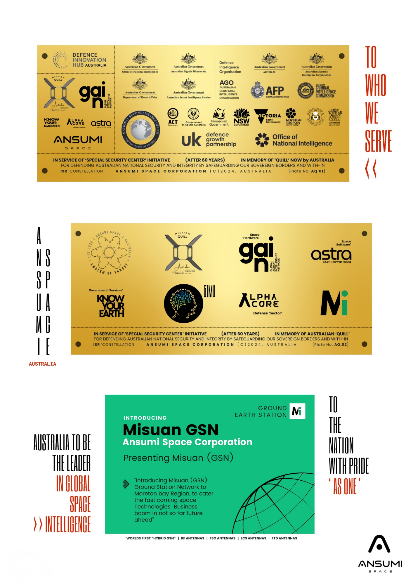
Ansumi Quill Services to Australia
Ansumi Quill is envisioned as Australia’s sovereign space-intelligence service platform, delivering persistent Earth observation, ISR, SAR and space-derived intelligence for national security, border protection and strategic decision-making. Through Ansumi’s ASTRA, ALPHA CORE, GAIN and Quill capabilities, Australia can access timely intelligence across land, maritime and critical infrastructure domains. The service is designed to support Defence, intelligence agencies, law enforcement, emergency management, state governments and trusted national institutions. Supported by Ansumi’s planned MISUAN Ground Station Network, Quill connects space-based intelligence with Australian decision-makers, strengthening sovereign situational awareness, protecting national borders and enabling Australia to become leader in space intelligence.
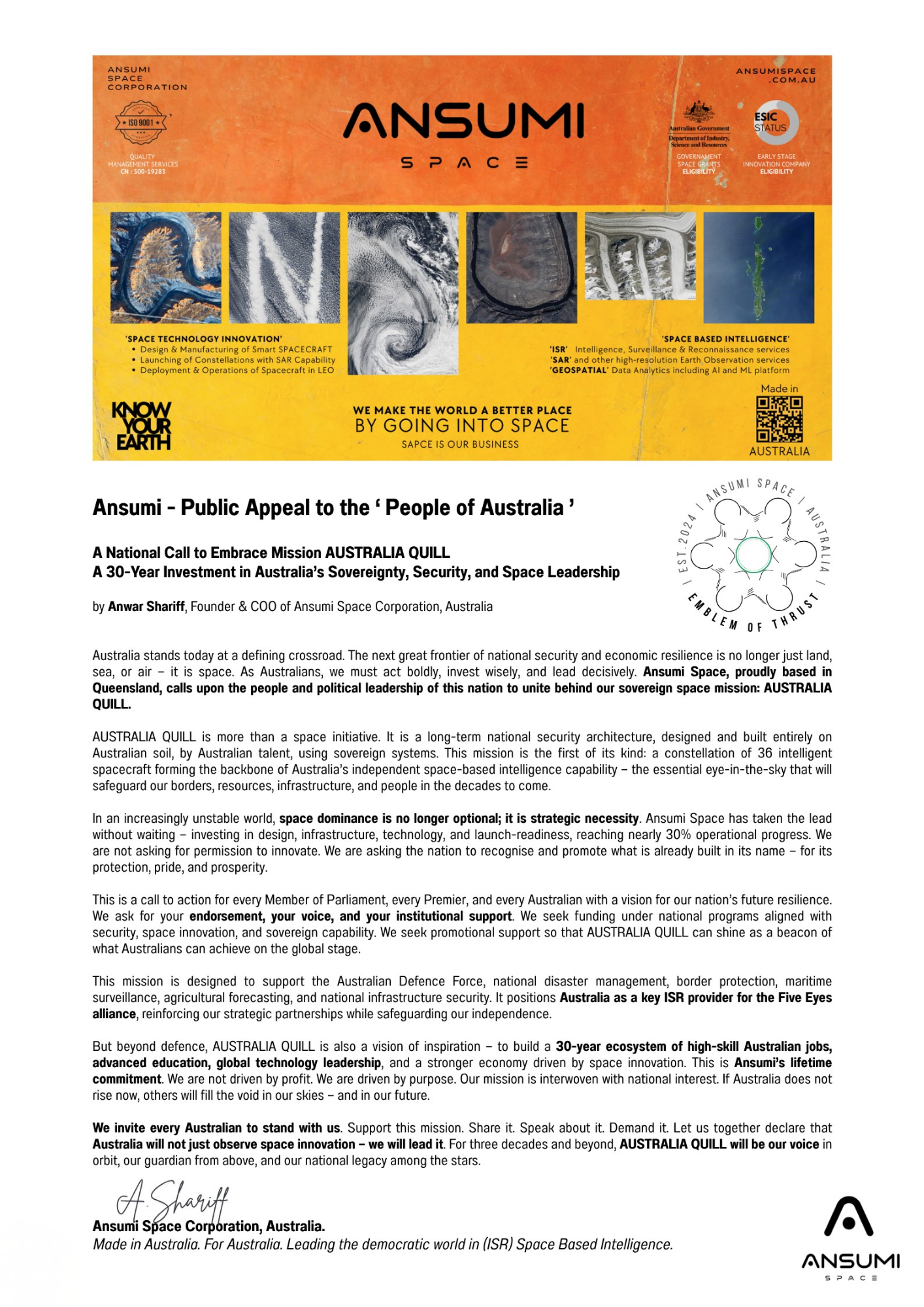
Australia’s future in space begins with QUILL, join Ansumi in building sovereign intelligence
protecting australia interests and securing our tomorrow today.
ansumi ‘quill:
Built for australia
In this exclusive interview, Ansumi Space Chairman Anwarulla Shariff shares the real story behind building Australia’s sovereign space future. From the original vision of creating national independence in intelligence, surveillance and reconnaissance through a dedicated Synthetic Aperture Radar constellation, to the intense hard work, leadership lessons and difficult choices along the way, he offers a candid look at what it takes.
Ansumi is re-engineering space systems to transform them into true decision-making machines, drastically reducing the time from data to insight from hours to minutes and enabling persistent 24/7 visibility. The conversation explores the commitment to product sincerity over short-term profitability, the careful approach to funding and investors, and the unwavering focus on delivering lasting sovereign capability.
Watch the full discussion to understand the purpose, the challenges and the ambition driving Ansumi Space as it works to give Australia independent, reliable and rapid space-based intelligence for the decades ahead.

Ansume describes its space systems “as a decision machine”

ansumi launch of “a500 bus” @ qut aerospace society, brisbane 2025
What does it really take to build
“a sovereign space future”

ansumi launch of “quill mission” @ qut aerospace society, 2025

What kind of legacy does ansumi space hope to leave behind for space domain

What does sovereign space capability really mean for Australia

What if the future of space isn’t a single satellite-but an intelligent ecosystem

What will space intelligence look like by 2035 in real world

Will the next generation of spacecraft think before they transmit “in strategy”
Initiate a Productive Dialogue
Complete the form with contextual information regarding your challenges, timelines, and desired outcomes, and our team will respond with an evidence-based recommendation framework.